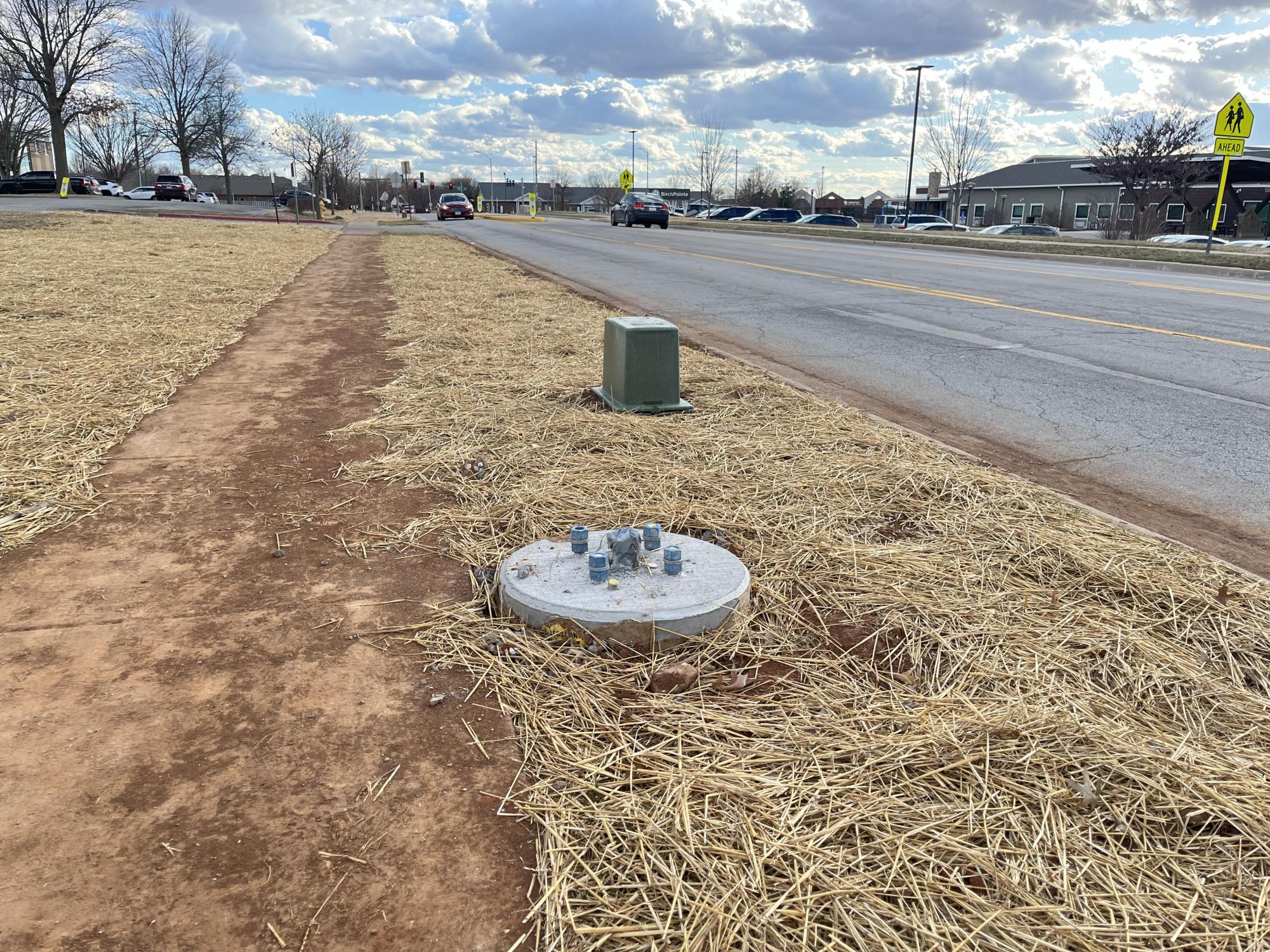
In a bid to enhance community safety and foster a brighter environment, Principal Dr. Bill Powers submitted a request to put in street lights on Jefferson Avenue, a little over two years ago.
“We have two lights being put in at the crosswalk, one on each side of the street, and then a few more starting at Primrose and Jefferson down to the first entrance to the school on Jefferson. In the mornings and evenings, we have lots of students use this sidewalk and crosswalk. The new lights will provide a safer space for everyone to walk and bike,” Powers said.
Springfield Public Schools (SPS) then contacted the officials with the city and City Utilities to address the request.
“The Board has nothing to do with the project, nor does SPS. It is funded by the City of Springfield and City Utilities as they are the ones responsible for the lights,” Powers said.
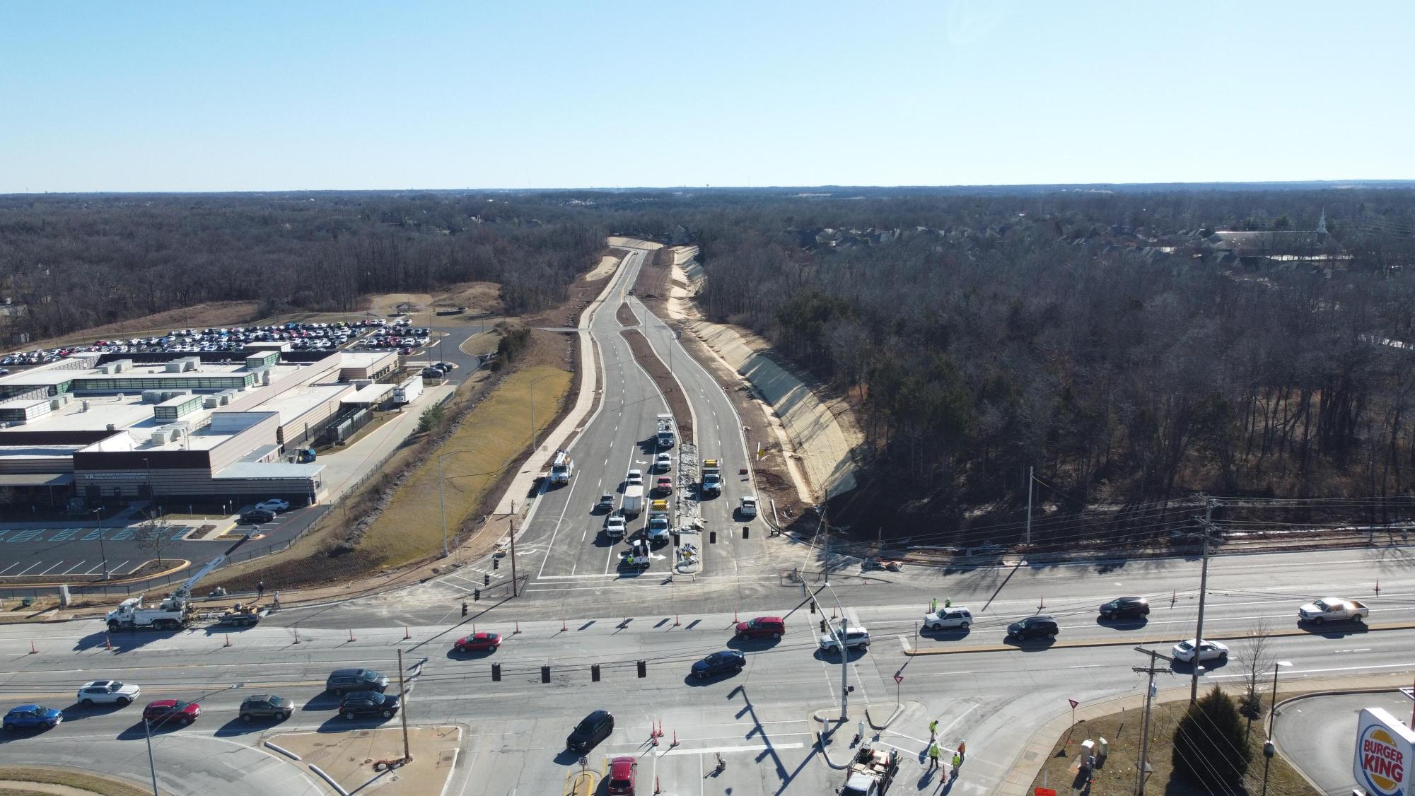
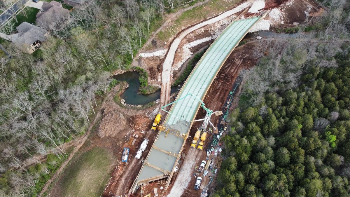
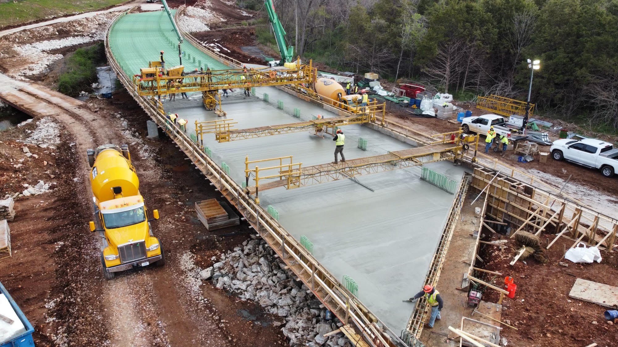
(Photo by Mark Webb)
Along with the street light improvement project, Kansas Expressway has been experiencing some major changes as well.
Mark Webb is Assistant Administrator of the Greene County Highway Department.
Webb plans, manages, and oversees road and bridge construction projects, and supervises permitted right-of-way activities.
He comments on the expansion.
“This process started about 30 years ago and started before my time here. Currently the county, like most jurisdictions, probably has a master plan of where they want things to look like in the future,” Webb said.
Webb also remarked that an individual had outlined markings on the map to indicate the expansion plans. The location earmarked for road expansion has been thoroughly examined and has been in the planning stages for some time.
“As time went on, the county was purchasing property at right of way to be in preparation for this project, it’s been in the works for quite a while. When they finally pulled the trigger of getting alignment, a plan was developed, here’s how we could potentially build this corridor and with that comes all sorts of things that have to be looked at,” Webb said.
Studying the environment, including waterways and other aspects, requires a considerable amount of time.
Over the years, they consistently invoiced steam and obtained approval. In 2021, they finally greenlit the project, and the construction commenced in January 2022, marking the initiation of the first phase.
The intersection that exists now on Plainview, back to the south, Webb states that phase two of the project is going to be constructed.
“They were probably back there trimming and getting those trees knocked down and preparing that corridor for construction and that’ll continue farther south for the phase two portion. It’s going to end up at Farm Road 1-90,” Webb said.
There is another line on the map that heads East and that’s what the Highway Department calls their East-West corridor arterial. The upcoming stage will involve progressing from the position marked as 1-90. Subsequently, the phase will proceed eastward and, ultimately, extend from that location to Highway 65. “Whenever people are putting lines on a map, they’re trying to predict what the future will look like, where’s the development going and where we will need roads,” Webb said.
The purpose of drawing lines on maps varies depending on the context. Some common reasons include delineating political boundaries between countries, states, or regions; marking geographical features such as rivers, coastlines, and mountains; indicating transportation routes like roads, railways, and flight paths; and representing administrative divisions like counties, municipalities, and districts.
“One of the things that the county tries to do is there’s always something in the works. For example, last year, we completed about four or five bridge replacement/reconstruction projects scattered around the county. Those projects are based on bridge condition surveys and we have several hundred culverts and bridges throughout the county. Whichever one is in a bad condition moves to the top of the list,” Webb said.
Major projects, like this Kansas expansion, took not only years to prepare but also the funding for it.
“The colonization of the approval process and the funding, converging at one point, so now we are ready to pull the trigger and move on,” Webb said.
This project has positively and negatively impacted the community.
“Positively, I think, already, we’ve heard comments on how it’s another alternative route as you’re traveling in that southern part of the Springfield area, for example, right now, MoDot is expanding the number of lanes on Campbell and James River Freeway,” Webb said.
According to springfieldmo.gov,
“ In Spring of 2022, Springfield Public Works and the Missouri Department of Transportation (MODOT) teamed up to collectively bid the Republic Road improvement project alongside interchange improvements to Campbell Avenue and James River Freeway. Contractor Capital Paving and Construction was awarded the projects and is completing construction on MoDOT and the City’s projects concurrently. Coordination between the projects will help reduce traffic impacts, increase safety for motorists during construction and help reduce overall costs.”
Traffic on James River Freeway already sucks as is, especially with only a few lanes open right now. Imagine how it would be if they had to close one more lane.
“In order to do that, they have to make the bridge bigger, they need to drill new piers on each side of it to support the bridge, the drilling machine in order to drill the pier, they have to block a lane of traffic and as a result, traffic is going to build up, so people can bail off of those roads and use Plainview or Weaver to reach their destination,” Webb said.
Another positive feature is a ten foot walking/biking trail. Mark said that every time he goes and sees the sight, there are multiple people using the trail.
The negative impacts of the Kansas expansion has taken a toll on people in the community, as well.
“The people and houses along that corridor enjoyed for many years the fact that it was just woods behind there, and when the decision was made to expand Kansas and then we started construction, they took those trees out fairly quick and I believe that it was a big shock to those people,” Webb said.
The expansion and construction of both Jefferson and Kansas expressways, both have positive and negative aspects to our community and it is our job to recognize how it could help us as humans and as a community.